Zermatt Tickets
English
CHF
Language
Currency
Contents

Gornergrat hikes | Scale the Alpine heights

Looking for an adrenaline rush along a high ridge? Or maybe you enjoy the tranquility of birdwatching and being surrounded by nature? Hiking in Gornergrat offers the perfect blend of adventure and relaxation. Get ready to lace up your boots and explore one of Switzerland's most picturesque landscapes!

Easy hikes

Challenge trail

  • Starting point: Gornergrat 
  • Ending point: Rotenboden
  • Distance: 1.7 km
  • Duration: 1 hour
  • Best season: January - March

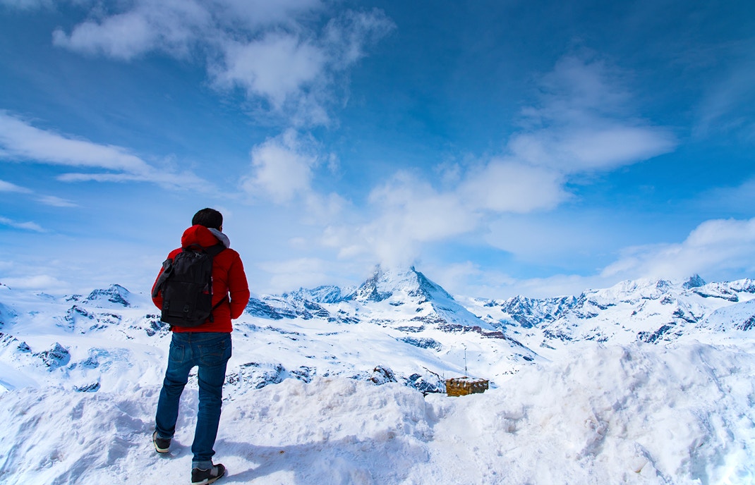
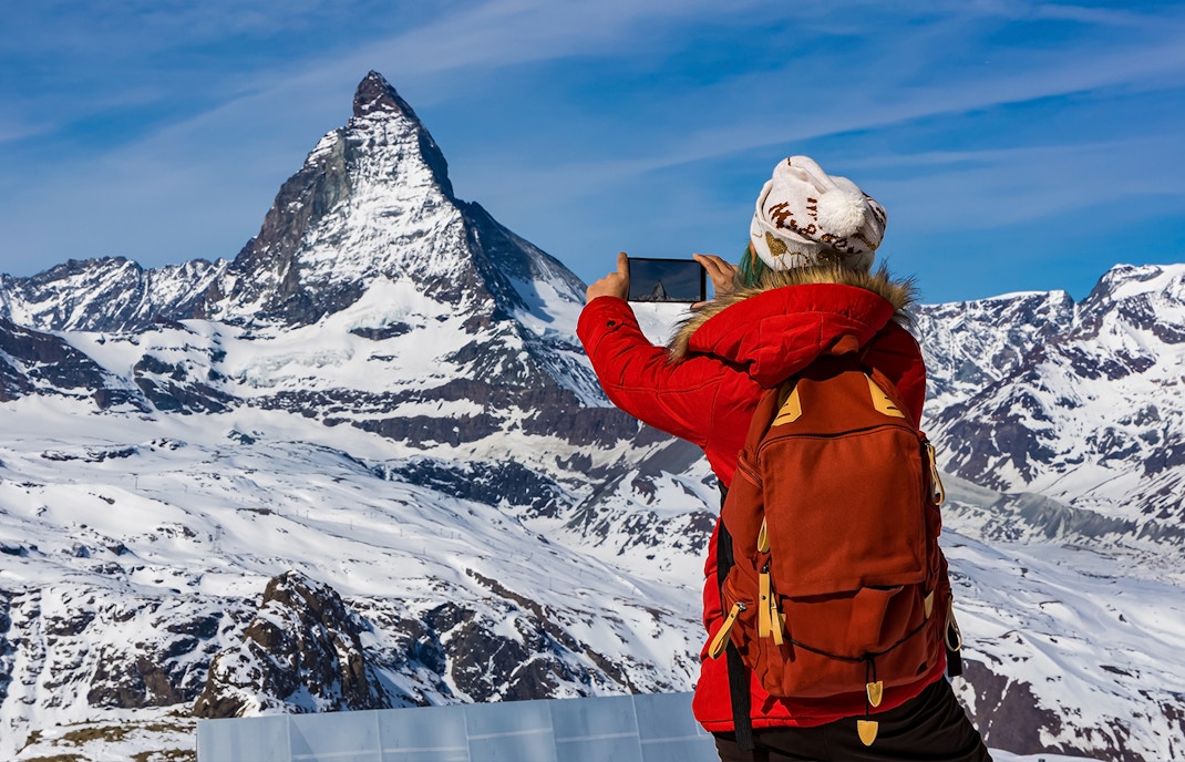
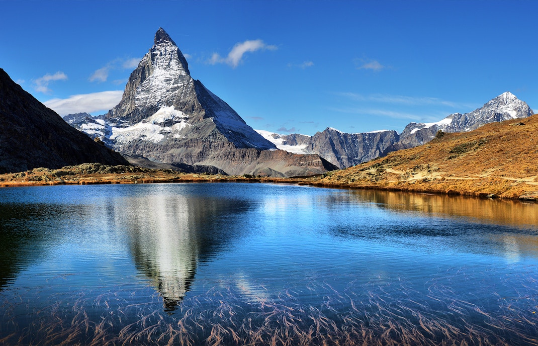
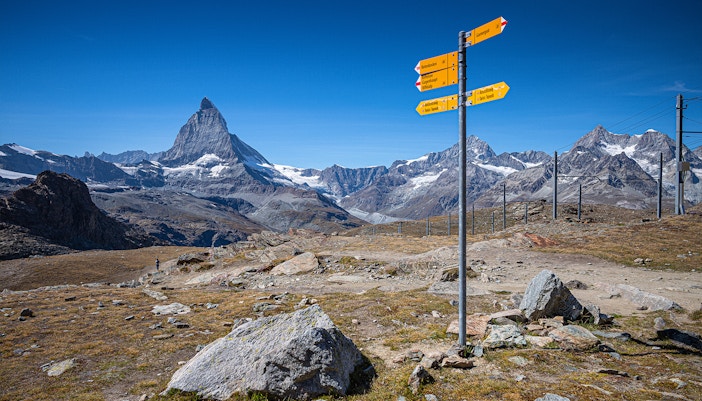
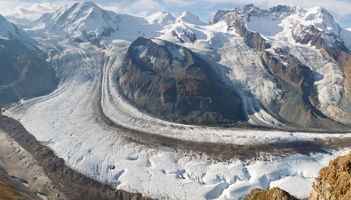
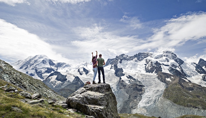
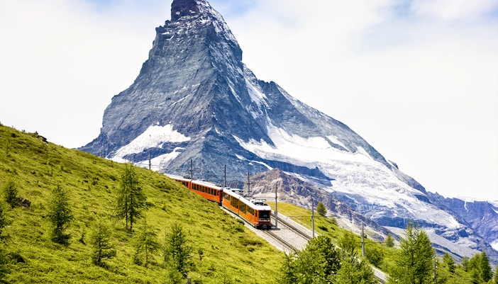
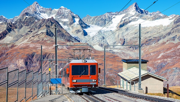
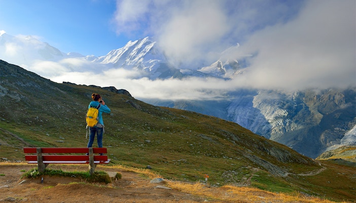
The snowshoe trail from Gornergrat to Rotenboden only goes downhill. It's a route that follows closely alongside the Gornergrat Bahn railway line, descending 274 meters from Gornergrat to Rotenboden. See the Matterhorn, Klein Matterhorn, Breithorn, and other peaks on this scenic trail. 

Tips

  • Look for pink markers about every 100 meters along the path.
  • Stick to the marked trail to minimize disruption to wildlife.
  • If you're up for more snowshoe hiking, you can extend your journey along the Panorama Trail to Riffelberg.

Rotenboden - Riffelberg

  • Starting point: Rotenboden
  • Ending point: Riffelberg
  • Distance: 2.3 km
  • Duration: 1 hour
  • Best season: December - April

On the Rotenboden to Riffelberg trail, children can sled down parts while enjoying views of the Matterhorn, Weisshorn, and other majestic Alpine peaks. It showcases some of the finest winter scenery you’ll ever come across. 

Tips

  • Hiking poles are only optional for this hike as it is fairly simple.
  • Ride the Gornergrat Bahn to the top for amazing views of 29 towering peaks and glaciers and mountains. Then, head back down to Rotenboden to continue your journey.
  • Get an extra RECCO rescue reflector for added safety. RECCO reflectors are devices that help rescuers locate you in case of emergencies, especially in snowy or mountainous terrain.

Wolli and the climate detectives

  • Starting point: Zermatt
  • Ending point: Zermatt
  • Distance: 21.2 km
  • Duration: 2 hours 30 minutes
  • Best season: July - October

Wolli and the Climate Detectives is an interactive trail for kids starting at Zermatt Tourism near the railway station. Along the way, Wolli the Valais Blacknose sheep and his friends—squirrel, alpine chough, stone man, and the Matterhorn—challenge you with seven puzzles. Don't forget your cogwheel train ticket, as it's essential for the journey.

Tips

  • Pick up Wolli souvenirs such as postcards, Matterhorn replicas, cow bells and more at the Tourist Office by the train station to bring Wolli along on your adventures. 
  • During July to September, use an interactive map to see the black-nosed sheep.
  • You can also rent binoculars from Zermatt Tourism for a CHF 20 deposit.

Alpine garden/flower trail

  • Starting point: Gornergrat
  • Ending point: Gornergrat
  • Distance: 0.4 km
  • Duration: 30 minutes
  • Best season: June - September

Explore Gornergrat's Alpine Garden, Europe’s highest, among colorful plants and flowers. From Rotenboden station at 2,800 meters, enjoy views of the Matterhorn, Riffelhorn, and Lake Riffelsee. The garden covers over 5,000 square meters and features unique alpine flora thriving at high altitudes.

Tips

  • Look out for the Giant Scabiosa, which has arrived all the way from the Himalayas.
  • When you stroll through the Alpine Garden, keep an eye out for a unique green rock that supports its own specialized flora. The Rotenboden area boasts diverse geology, with alkaline soil from various rocks, creating a rich limestone flora. For geologists and mineralogists, Gornergrat is a treasure trove of different rocks to explore.

360° Loop hike on Gornergrat

  • Starting point: Gornergrat
  • Ending point: Gornergrat
  • Distance: 0.5 km
  • Duration: 15 minutes
  • Best season: June - October

The 360° Loop Gornergrat gives you an opportunity to see the Monte Rosa massif, Switzerland’s highest peak (Dufourspitze), the Gorner Glacier, and 29 other peaks over 4,000 meters, including the Matterhorn. You can also spot wild ibex along the way.

Tips

  • Below the viewing platform is the 3100 Kulmhotel Gornergrat, making it a perfect spot for a quick bite to eat.
  • At the viewing platform where the hiking trail starts and ends, you can use free Viscopes. These telescopes show names of mountains, villages, and trails right in front of you.
  • You can also check out the multimedia experience ZOOOM the Matterhorn nearby.

Moderate hikes

Panorama trail

  • Starting point: Rotenboden
  • Ending point: Riffelberg
  • Distance: 2.5 km
  • Duration: 1 hour 30 minutes
  • Best season: January to April and December

This snowshoe trail from Rotenboden to Riffelberg is far from the ski pistes and offers views of the Matterhorn, Obergabelhorn, and Weisshorn. Passing the frozen Riffelsee, draped in snow, it captures the blue hour as the Riffelhorn casts its shadow.

Tips

  • This trail offers stunning views with peaks like the Matterhorn and Weisshorn. Bring your camera!
  • The trail is marked with pink poles approximately every 100 meters, so be sure to rely on them.

Riffelalp trail

  • Starting point: Riffelalp
  • Ending point: Winkelmatten 
  • Distance: 4.2 km
  • Duration: 1 hour 30 minutes
  • Best season: June - October

This pleasant walk takes you through Zermatt's forests, filled with larches and Swiss stone pines. You'll catch glimpses of the Matterhorn and the green slopes of Schafberg, where the Matterhorn Express gondolas glide up.

Tips

  • Keep an eye out for the rare roe deer. You might also catch a glimpse of nutcrackers, the typical birds of the mountain forests.
  • At Riffelalp, you'll see the highest tramway in Europe. The railway winds through Alpine pine and larch tree forests. Take a moment to consciously breathe in the forest's scent.

Nature trail

  • Starting point: Riffelalp
  • Ending point: Sunnegga
  • Distance: 6.2 km
  • Duration: 1 hour 40 minutes
  • Best season: June - October

The nature trail begins in a forest with ancient Swiss stone pine trees, then transitions into the open landscape left by the retreating Findel Glacier. The trail offers views of numerous 4,000-meter peaks, including the iconic Matterhorn.

Tips

  • Stop by Leisee lake and indulge in swimming, rafting, and treat yourself to a good barbecue.
  • You can also visit the Grünsee lake for a good swim.

Scenic trail

  • Starting point: Gornergrat
  • Ending point: Rotenboden
  • Distance: 2 km
  • Duration: 40 minutes
  • Best season: July - October

This hike offers views of 29 Alps peaks over 4,000 meters, including Matterhorn and Breithorn. Along the trail, enjoy alpine flowers like gentians and anemones, and capture photos of the Gornergrat Bahn cog railway.

Tips

  • Stop by the observation platform in Gornergrat for some great views of the mountains.
  • Keep an eye out for ibex; with a bit of luck, you might spot them, especially at the salt posts set up on Gornergrat.

Matterhorn view trail

  • Starting point: Gornergrat
  • Ending point: Riffelberg
  • Distance: 5.7 km
  • Duration: 1 hour 50 minutes
  • Best season: June - October

Explore the Matterhorn View Trail from Gornergrat to Riffelberg, where you'll see 11 informative stations. Learn about Gornergrat Railway's history and uncover the traditions of Zermatt. Each station features a stone figure and a QR code for an immersive experience.

Tips

  • Look out for the popular Valais black-nosed sheep along the way.
  • Make sure to ask for the map with live tracking of the herd of sheep.
  • Don't forget: at the end of the hike, join the quiz for a chance to win amazing prizes.

A hike with a glacier view from the Gornergrat to Riffelberg

  • Starting point: Gornergrat
  • Ending point: Riffelberg
  • Distance: 6.3 km
  • Duration: 2 hours 30 minutes
  • Best season: June - October

This hike begins at the Gornergrat mountain station. Follow the trail along the Hohtälli ridge, where you'll navigate a steep descent toward the Gorner Glacier. Here, you can get a unique view of the Matterhorn ahead of you.

Tips

  • Make sure to stop at Riffelsee lake to snap some photos or enjoy a picnic.
  • It’s always a good idea to keep a printout of the route with you for better navigation.

Winter hike from Riffelalp to Findelbach

  • Starting point: Riffelalp
  • Ending point: Findelbach
  • Distance: 4 km
  • Duration: 1 hour 20 minutes
  • Best season: January - April, December

The route starts at the charming Riffelalp and winds through an Arven forest. You'll also enter the forest near the Alphitta restaurant, where a path leads downhill to the Chämi Hitta restaurant. The trail zigzags down toward Furi, following the snow-covered Furistrasse road to Findelbach.

Tips

  • Enjoy a slice of homemade cake or one of their specialty coffee creations at the Chämi Hitta restaurant.
  • At the end of the hike, you can take a comfortable Gornergrat train from Findelbach back to the center of Zermatt. But if you’re feeling up for it, you can also choose to continue walking down to Zermatt.

Winter Wonder Trail snowshoe tour from Sunnegga to Riffelalp

  • Starting point: Sunnegga
  • Ending point: Riffelalp
  • Distance: 7.7 km
  • Duration: 3 hours
  • Best season: January - April, December

The tour starts at the Sunnegga mountain station. Look out for the snow-covered lakes: first, you'll pass Mossjisee lake, and across the valley, Grünsee lake is hidden beneath deep snow. This hike is enjoyable in both summer and winter.

Tips

  • Make sure to take a coffee break or enjoy lunch in Findeln. The dining options there offer great food with an alpine atmosphere.
  • Enjoy superb food at the mountain lodge Ze Seewjinu.
  • After walking through the Swiss pine forest to reach Riffelalp, you have the choice to eat at either the upscale Riffelalp Resort or the cozy Alphitta for a more relaxed dining experience.

Discovery Trail snowshoe tour from Sunnegga to Riffelalp

  • Starting point: Sunegga
  • Ending point: Riffelalp
  • Distance: 5.6 km
  • Duration: 2 hours 30 minutes
  • Best season: January - April, December

The tour winds through a Swiss stone pine forest, where ancient, twisted trees and larches border the snowshoe path. The goal is to reach Findeln, renowned for its mountain restaurant and inviting sunny terraces. From Findeln, you get an exceptional view of the Matterhorn.

Tips

  • Begin your hike early so you can soak up the sun in Findeln for an extended period.
  • Make sure to check out mountain restaurants like Chez Vrony, Findlerhof, or Adlerhitta—they all serve some of the best gourmet food around.
  • Towards the end of the hike, if you're looking to indulge, the Riffelalp Resort offers luxury, while the Alphitta restaurant provides a cozy atmosphere with traditional Wallis charm.

The Mark Twain Trail from the Riffelberg to Riffelalp

  • Starting point: Riffelberg
  • Ending point: Riffelalp
  • Distance: 3.5 km
  • Duration: 1 hour
  • Best season: June to October

Walk in the footsteps of American writer Mark Twain on the Riffelberg trail, enjoying views of the Matterhorn. In his funny story ‘Climbing the Riffelberg,’ Twain poked fun at 19th-century expeditions in the Zermatt Alps. This hike promises a delightful experience with views of Weisshorn and other famous peaks around Zermatt.

Tips

  • Get your hands on 'Climbing the Riffelberg', a booklet featuring Mark Twain's narrative in both English and German. In it, Twain (1835–1910) humorously teased the exaggerated excitement surrounding 19th-century expeditions exploring the mountains near Zermatt.
  • Look out for the highest tramway in Europe at Riffelalp.

The Riffelsee lake trail from Rotenboden to the Riffelberg

  • Starting point: Rotenboden station
  • Ending point: Riffelberg station
  • Distance: 3.1 km
  • Duration: 1 hour
  • Best season: May - November

This path leads to an amazing photo spot: Riffelsee, where the Matterhorn reflects in the lake with a small rock, surrounded by pristine nature. The hike starts at Rotenboden station, where you'll see the lake on the left side of the tracks. Near the end, you'll reach Brother Klaus chapel on Riffelberg.

Tips

  • While the main lake is beautiful, just a short walk further you'll find a smaller, equally picturesque lake.
  • You might want to consider riding all the way up to Gornergrat on the Gornergrat Bahn cog railway. From the observation platform, you'll get an amazing view of glaciers and mountains, with 29 peaks over 4,000 meters. Then, head back down to Rotenboden.

The Sunshine Trail from the Gornergrat to the Riffelberg

  • Starting point: Gornergrat
  • Ending point: Riffelberg
  • Distance: 3.1 km
  • Duration: 1 hour
  • Best season: June - October

The trail descends on the right-hand side of the Gornergrat railway, over open and rocky terrain. Just below Gornergrat, you'll come across 'Chalet Bomber', where an essential worker, the points cleaner, spends the winter maintaining the railway switches to ensure trains stay on track, free of ice and snow.

Tips

  • At Rotenboden station, the rocky terrain gives way to alpine meadows. Keep an eye out for the black-nosed sheep grazing here.
  • You wouldn't know it in summer, but in winter, this is where the big igloo village is located, where guests can spend the night.

The Path of Silence from the Gornergrat to Riffelalp

  • Starting point: Gornergrat
  • Ending point: Riffelalp
  • Distance: 7.9 km
  • Duration: 3 hours 15 minutes
  • Best season: June - October

This trail goes from Gornergrat down into a quiet valley where you might spot wildlife. It passes by Kellensee lake, used in winter to make artificial snow for the slopes. You'll walk through alpine meadows before reaching the rocky landscape near the lower part of Ritzigrat ridge.

Tips

  • Keep an eye out for chamois, mountain goats and ibex.
  • Enjoy delicious Wallis specialties at the 'Ze Seewjinu' mountain lodge.
  • Also keep an eye out for Alpine flora with edelweiss.
  • If you’re up for a swim, Grünsee lake is your best bet.

Easy round-trip hike on Riffelalp

  • Starting point: Riffelalp
  • Ending point: Riffelalp
  • Distance: 3 km
  • Duration: 1 hour
  • Best season: May - November

The hike starts at Riffelalp station, heading east (signposted towards Grünsee lake). The trail winds through the forest beneath the rocky 'Laubern' formation towards Grünsee lake. After passing small alpine meadows, the path turns right and ascends towards Riffelalp.

Tips

  • Read up on the historic Grand Hotel Riffelalp, once a playground for European high society, burned down in 1961. It reopened in the late 1980s and became the 5-star Riffelalp Resort by the early 2000s. You will come across its location during this hike.
  • Don’t forget to catch a glimpse of the Matterhorn.

4 lakes hike from Sunnegga to Riffelalp

  • Starting point: Sunnegga
  • Ending point: Riffelalp
  • Distance: 10.2 km
  • Duration: 3 hours 30 minutes
  • Best season: June - October

The 4 Lakes Hike takes you to four beautiful alpine lakes surrounded by rare mountain flowers and towering mountains. You'll visit Leisee, Stellisee, Grindjisee, and Grünsee lakes. The trail concludes through a charming forest of larches and Swiss stone pines towards Riffelalp.

Tips

  • When you get to Stellisee, be sure to stroll around this lake known for its reflection of the Matterhorn.
  • Look out for plenty of vibrant alpine flowers just above Grindjisee lake. 
  • The trail then crosses a glacier moraine, a remnant from the last ice age, which is also a specialty of this hike.

Face to face with the Matterhorn from Rotenboden to the Riffelalp

  • Starting point: Rotenboden station
  • Ending point: Riffelalp station
  • Distance: 5.9 km
  • Duration: 1 hour 30 minutes
  • Best season: June - October

Not far from Rotenboden station, you'll see Riffelsee lake. A short walk later, you'll reach the first highlight: a peaceful mountain lake with a perfect reflection of the Matterhorn. The trail also crosses open fields with views of the Weisshorn, and gently descends through meadows and a small forest to Riffelalp.

Tips

  • Keep a lookout for alpine flowers, and you might just spot the famous edelweiss.
  • You can also catch a glimpse of Europe’s highest tramway running between the hotel and railway station, restored to its original form in 2001.

Difficult hikes

Glacier trek to the Monte Rosa hut

  • Starting point: Rotenboden 
  • Ending point: Monte Rosa hut
  • Distance: 8 km
  • Duration:  3 hours 30 minutes
  • Best season: June - September

In this trail, you traverse glaciers and moraines. Starting from Rotenboden, the trek follows an easily accessible trail along the extended lateral moraine. Further along, the path continues straight to the Gorner Glacier. Here, a slight ascent on the glacier requires the use of crampons.

Tips

  • Instead of making a round trip on the same day, the modern Monte Rosa hut offers 120 beds for overnight stays. But you need to book ahead to stay overnight at the Monte Rosa hut.
  • The trail is rated as an alpine hiking T4 route according to the SAC scale, so it's recommended to have a mountain guide with you.

Swiss topwalk

  • Starting point: Riffelalp
  • Ending point: Gornergrat
  • Distance: 6.4 km
  • Duration: 3 hours
  • Best season: July - October

Enthusiastic runners use the Swiss Topwalk as a training route, while regular hikers also appreciate it. The trail starts gently through the forest and then ascends along the "Aussichtsweg" path up to Gornergrat. A highlight is the stunning reflection of the Matterhorn in Riffelsee lake.

Tips

  • Opt to descend back to the village on the Gornergrat Bahn cog railway, which is gentle on the joints. You can also take in the beautiful views, Matterhorn included!
  • Pause at Riffelsee lake to marvel at the reflection of the Matterhorn.

Glacier garden trail

  • Starting point: Riffelberg
  • Ending point: Furi
  • Distance: 6.2 km
  • Duration: 1 hour 50 minutes
  • Best season: June - October

The trail descends into the landscape of the Gorner Glacier and offers great Matterhorn views. At the Gletschergarten Dossen (Dossen Glacier Garden), visitors can explore what glaciers typically hide: smooth-polished boulders, glacial mills, and peculiar rock formations.

Tips

  • If you’re going in July or August, make sure to look out for edelweiss.
  • Near the Dossen Glacier Garden, you'll find picnic areas, barbecue spots, and a children’s playground—perfect for enjoying a break.

Your Gornergrat hiking checklist 

Travel essentials

  • Water: Stay hydrated with enough water to keep you refreshed during the hike.
  • Snacks: Pack lightweight, energy-boosting snacks like nuts, granola bars, and fruits.
  • Proper hiking shoes: Wear sturdy and comfortable shoes for support on uneven terrain.
  • Weather-appropriate clothing: Dress in layers and consider weather changes in mountainous areas.
  • Rain gear: Carry a waterproof jacket or poncho for unexpected rain.
  • Sun protection: Wear a wide-brimmed hat, sunglasses, and apply sunscreen.
  • First-aid kit: Carry basic essentials like band-aids, antiseptic, and pain relievers.
  • Map and compass: Have a map and compass for navigation, or download an app before setting out on your hike!
  • Charged phone: Bring a fully charged phone for emergencies and navigation.
  • Trekking poles: Optional, but can provide extra stability on descents.
  • Camera: Capture amazing views and memories.

Things to keep in mind

  • Leave no trace: Dispose of waste properly by packing out all trash, including biodegradable items like food scraps and toilet paper. Minimize campfire impacts and leave natural objects undisturbed.
  • Be mindful towards wildlife: Observe ibex and sheep from a distance to avoid disturbing their natural behaviors. Do not approach or feed wildlife.
  • Practice fire safety: Obtain necessary permits for campfires where allowed. Use existing fire rings or stoves, and fully extinguish fires before leaving.
  • Stay on marked trails: Avoid creating new trails that can erode the landscape and disturb habitats. Follow signs and markers to stay on designated paths and do not walk on the ski pistes.
  • Do not disturb the plants and flowers: Trails such as the Alpine garden or flower trail feature delicate ecosystems where it's crucial to refrain from stepping on or picking the flowers. Enjoy the natural beauty while being mindful of your environmental footprint.
  • Stay away from glaciers: Please refrain from stepping onto glaciers or straying from designated hiking paths without the assistance of a mountain guide.
  • Know your facilities: Check the hiking map before you set out on your hike, so you know the facilities in your route and at base station. For example, the loop hike starts and ends behind the 3100 Kulmhotel, where you can stop for refreshments.


Book your Gornergrat Railway tickets

Round-Trip Train Tickets to Mount Gornergrat from Zermatt
Free cancellation
Instant confirmation
Mobile ticket
Flexible duration
More details
from
CHF 121
Swiss Travel Pass: Train, Bus, Boat, Cable Car & 500 Museums Tickets and Public Transport Discounts
Free cancellation
Mobile ticket
Flexible duration
More details
from
CHF 244

Frequently asked questions about Gornergrat hiking

Can I bring an elderly person or my child with me for the hike?

Yes, you can bring elderly persons and children on the hike to Gornergrat, but consider their physical abilities and the altitude. The hike can be challenging due to steep sections and high altitude, but you can always opt for the shorter and easier hikes.

What is the best time of year for hiking at Gornergrat?

The best time is from mid-summer to early autumn when the weather is generally more favorable and the trails are accessible.

Do I need a guide to hike at Gornergrat?

It's not mandatory, but for some longer or more challenging trails, having a guide can enhance the experience and ensure safety. The trails are well-marked with signposts and direction indicators, making them relatively easy to follow, if you don’t go with a guide.

Are there any facilities or rest stops along the hiking trails?

Yes, there are mountain restaurants and lodges along the trails where you can rest, enjoy refreshments, and take in the views.

What if I get injured while hiking, are there any hospitals along the way?

There are no hospitals along the hiking trail to Gornergrat. It's essential to take precautions and be prepared with a first aid kit. In case of serious injury, emergency services can be called for assistance.

Are there any safety precautions I should take during the hike?

Always carry enough water, snacks, and a first aid kit. Check the weather forecast and be prepared for sudden weather changes. Follow marked trails and stay on designated paths.

Are dogs allowed on the hiking trails at Gornergrat?

Yes, dogs are generally allowed on the hiking trails, but they should be kept on a leash and their waste should be cleaned up.

Can I combine hiking with a visit to Gornergrat Railway?

Yes, the Gornergrat Railway offers a scenic way to reach the starting points of some hiking trails, allowing you to combine both experiences.

Do I need to make any reservations for hiking at Gornergrat?

Reservations are not required for hiking, but it's a good idea to check trail conditions and any specific guidelines before setting out.

Can I camp at Gornergrat?

Yes, there are some spots you can camp at when hiking to the top. There are ample flat grassy areas suitable for pitching tents on Gornergrat, just beyond Riffelsee.

Will there be cell reception during the hike?

Network coverage should generally be available, but if not, Wi-Fi is accessible at the Gornergrat Bahn stations. If you're uncertain about your phone's signal, it's advisable to hike in larger groups.

More reads

Timetable

Summit

About